 Contact
 Comment faire ses achats
Livraison
Guide d'achat
Python Recipes for Earth Sciences
 Anglais
 219 b
219 b
 Livraison à Autriche
Politique de retour sous 30 jours
Ceci pourrait également vous intéresser


 /
/
 Livre relié
 17.99
€
17.99
€

 /
Livre de poche
12.69
€
/
Livre de poche
12.69
€


 /
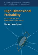
Livre relié
64.39
€
/
Livre relié
64.39
€

 /
Livre de poche
14.69
€
/
Livre de poche
14.69
€


 /
Livre de poche
20.99
€
/
Livre de poche
20.99
€


 /
Livre relié
26.09
€
/
Livre relié
26.09
€
Python is used in a wide range of geoscientific applications, such as in processing images for remote sensing, in generating and processing digital elevation models, and in analyzing time series. This book introduces methods of data analysis in the geosciences using Python that include basic statistics for univariate, bivariate, and multivariate data sets, time series analysis, and signal processing; the analysis of spatial and directional data; and image analysis. The text includes numerous examples that demonstrate how Python can be used on data sets from the earth sciences. The supplementary electronic material (available online through Springer Link) contains the example data as well as recipes that include all the Python commands featured in the book.


À propos du livre
Anglais

Offrez ce livre dès aujourd'hui
C’est simple
1 Ajouter au panier et choisir l'option Livrer comme cadeau à la caisse. 2 Nous vous enverrons un bon d'achat 3 Le livre arrivera à l'adresse du destinataireBonjour ! Je suis Libroamiko, votre conseiller littéraire.
Comment puis-je vous aider ?